|
|
| The Cotswold Landscape Circle |
|
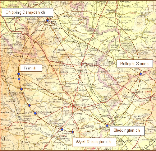
| Fig. 1 Showing the Cotswold Landscape Circle |
| Site |
Grid Reference |
Description |
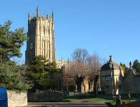
| Chipping Camden Church |
1550 3947 |
Dedicated to St James. Rebuilt in 1500 CE |
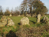
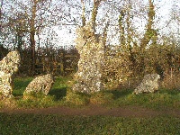
| Rollright Stones |
2963 3087 |
Bronze Age circle site circa 2500 BCE |
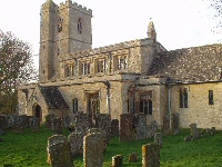
| Bleddington Church |
2451 2255 |
Dedicated to St. Leonard built circa 1150 CE |
| Wyck Rissington Church |
1918 2151 |
Dedicated to St. Lawrence built 12th century |
| Neolithic Settlement |
1697 2196 |
|
| Round Barrow |
1305 2456 |
|
| Salter's Pool |
1295 2462 |
Drover's pool |
| Round Barrow |
1290 2592 |
|
| Cutsdean Hill |
1047 3031 |
recumbent stone at top of hill |
| Barrow Group |
1043 3115 |
|
| |
|
|
| Centre |
1999 3101 |
No evidence of any monument at centre |
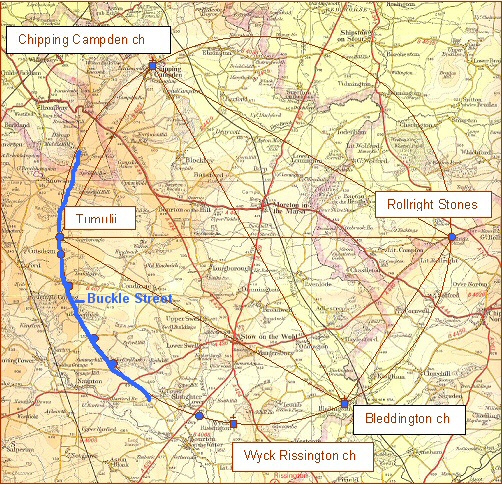
The Salt Way
The above map also shows an ancient salt way known as Buckle Street, that runs along a section of the circle for distance of about 10 kilometres or 6.25 miles. It was this striking feature that first drew attention to the existence of the circle.
 |
 |
 |
 |
 |
| St James church |
St. Leonards church |
St. Lawrence ch. |
Rollright stones |
Rollright stones |
© David Furlong 1998
Useful Links
follow on articles giving more details of other landscape
patterns.
Twin circles of the
Marlborough Downs explores sacred patterns of Wiltshire
Marlborough Downs
Sites a tour of the sites that make up the twin circle pattern
The Cotswold Circle an
article on a similar sized circle that over-lights the Cotswold area
The Hidden Geometry of
Avebury a look at the hidden geometry of Avebury
Silbury Hill and the Sanctuary an article on
significance of Silbury Hill and the Sanctuary
The Keys to
the Temple information on the book The Keys to the Temple by David Furlong
|
For further information please write to:
David Furlong Myrtles, Como Road, Malvern Worcs WR14 2TH
Tel: +44 (0)1684-569105 or Mobile: + 44 (0)777-978-9047
Email:
David Furlong |
|

David has been working as a healer, therapist and researcher for more than 40 years. He is the author of six books including The Healer Within and Working With Earth Energies
To contact David click here
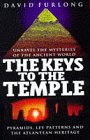
The book The Keys To The Temple from which the article is taken. Click the image for further details.
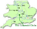
The location of the Cotswold
Circle
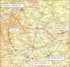
Fig. 1 The plan of the Cotswold Circle
whose centre lies close to Moreton-in- Marsh
(click image to enlarge)
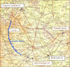
Fig. 2 The position of the road
Buckle Street which was also known as Salters' Way (shown in blue
on the map)
(Click image to enlarge)
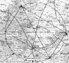
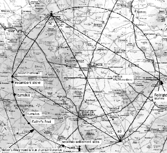
Fig 3. Alternative view of the
circle in greyscale.(Click image to
enlarge)/span>
|