|
Photos and Plans
Caesar's well on Wimbledon Common.
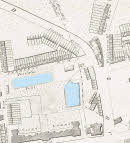
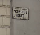
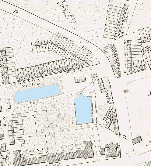
Peerless Pool, near Old Street, was a favorite bathing place fed by a natural spring. Click image to enlarge
Picture of the present location of the Peerless Pool
Street names still can be found refering to the old wells.
The position of the Kilburn well is located under Holland and Barrett's shop on the junction of Kilburn High Street and Belsize Road. A plaque on the building and another on the pavement commemorates the well.
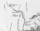
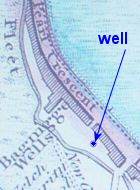
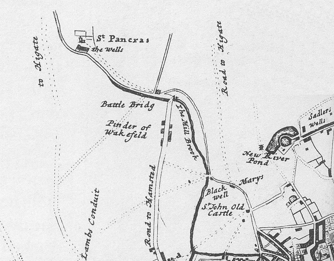
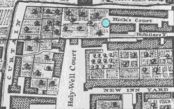
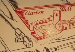
Old plan showing Black Mary's well and the St Pancras well. The map is dated to the early 1700's. Click to enlarge.
|
The concept of the ‘holy well’ or sacred healing spring dates back to Celtic times and before. As an important centre London had a number of ‘holy wells’ most of which, sadly, have long since disappeared. These pages are devoted to the spirits of water (undines) and to providing some up to date information about these sites. This is part of ongoing research and will be added to from time to time.
There are more than twenty holy wells or sacred springs connected with London. You can see the location and some information on all of these wells if you use Google Earth programme.
To download Google Earth you need a broadband dial up connection. Please click here to download the file. Then email me for a Google Earth file with the wells included. A sample of information is given below.
- Holy Well Aldwych (TQ 3087 8102)
-
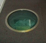
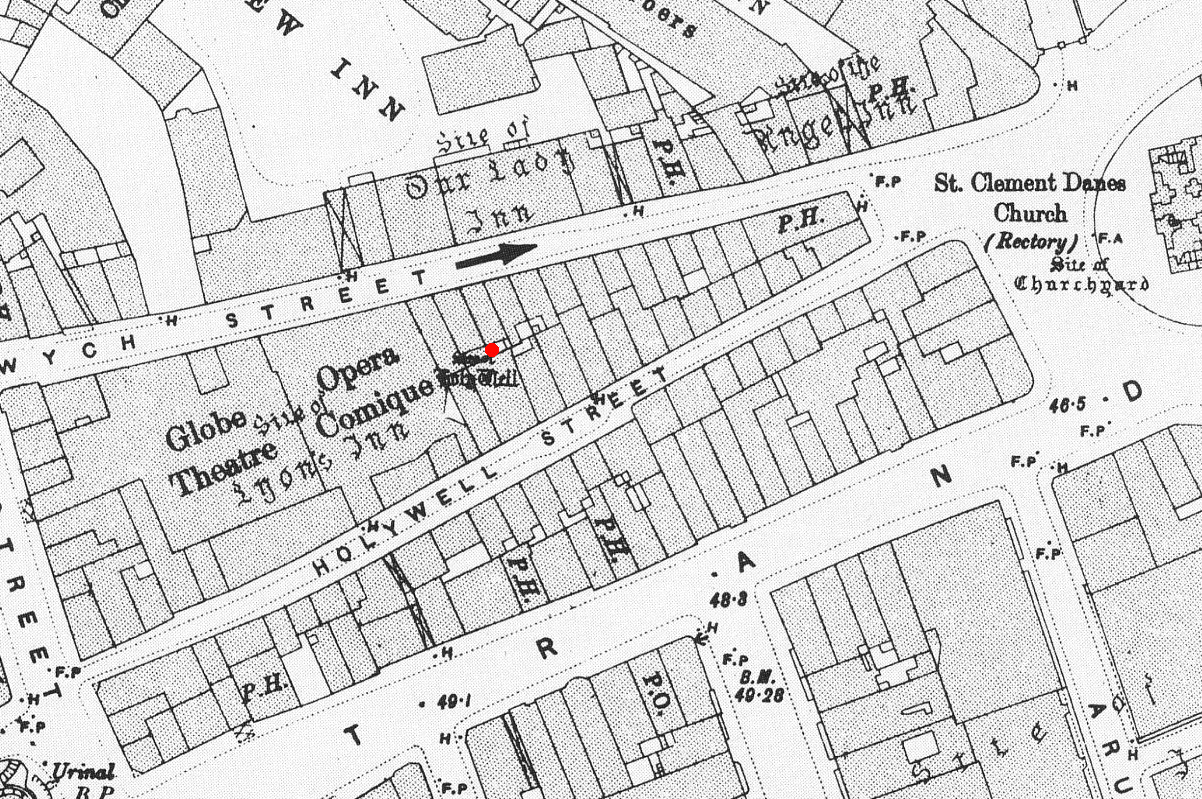
This ‘holy well’ is at present located in the basement of Australia House in the Aldwych, Strand, and can only be accessed via a manhole cover. At least it still exists and the water looks clean and wholesome, saving only a ubiquitous plastic cup floating on its surface - shame! The image has been doctored to remove this item.
|
|
The present 'Holy Well' under the Australian High Commission building in the Strand (click image to enlarge) |
Map showing position of the holy well, in Holywell Street, before the building of the Aldwych.(Click image to enlarge) |
- The first known mentioned of the well was by William FitzStephen (ca 1174/1183) a medieval monk who wrote:
“There are also in the northern suburbs of London springs of high quality, with water that is sweet, wholesome, clear, and "whose runnels ripple amid pebbles bright". Among which Holywell, Clerkenwell and St. Clement's Well have a particular reputation; they receive throngs of visitors and are especially frequented by students and young men of the city, who head out on summer evenings to take the [country?] air.
Truly, a good city – if it has a good lord.”
- However he could also have been referring to the 'holy well' in Shoreditch (see below). This could also be true of John Stow’s (1525 – 1603) London survey dated to 1598 where he states:
“Holywell is much decayed and spoiled, with filthiness purposely laid there for the heightening of the ground for garden plots.”
- When John Stryp edited the Stow survey in 1720, correcting what he thought were inaccuracies he states:
“Holywell is in a place which is first called Holywell-Street; tho' better known at the present by the name of the Back-Side of St. Clement's.”
- It is clear then that there is some confusion as to which 'holy-well' is indicated. That Stow later goes on to refer to the well of Dame Annis-the-Clear as being north of holywell strongly suggests that he was alluding to the Shoreditch well and not the one in the Strand.
- The site of the Strand holy well well is shown on the Ordnance Survey sheet of 1894 (see insert above) and has been confirmed by inspection.
St Clement’s Well, Strand (TQ 3096 8109)
- The site of this well is to be found in the west gardens of the Royal Courts of Justice in the Strand. A map dating to 1879 suggests a location in the centre of the West Gardens car park.
Of the well Stow states:
“The fountain called Saint Clements Well, north from the parish church of Saint Clements, and near unto an Inn of Chancerie, called Clement’s Inne, is yet fair and curbed square with hard stone and is always kept clean for common use. It is always full and never wanted water.”
- The well is shown as “site of” on the Ordnance Survey sheet of 1894 but no evidence survives today excepting perhaps a leaking drain.
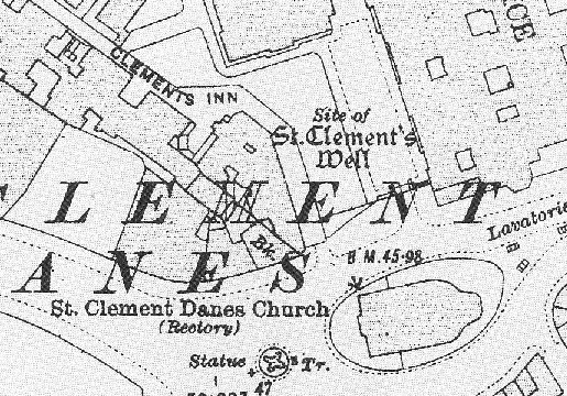
The location of St Clement's Well
- Sadler’s Well, Rosebery Street, (TQ3145 8283)
- The story of the well as it appears in the Sadler’s Well theatre is as follows:
*In June 1683 Dick Sadler, surveyor to the King, built a Musick-House near a country footpath leading from Clerkenwell to Islington.
By chance, earlier that summer he had discovered a medieval well in the grounds of his house. Believing the waters to have miraculous medicinal powers, people flocked to Sadler’s Wells to enjoy musical entertainment and to stroll in the gardens and take the water.”
- The well can still be seen today and has been incorporated into the new Sadler’s Wells Theatre.
The Sadler's Well
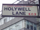
- Holywell, Holywell Lane, EC2 (TQ3315 8224)
- This is another of London’s holy wells that has long since disappeared under housing or road development. It is mentioned in John Noorthouck's History of London published in 1773 as follows:
“In the parish are two prebends, and part of a third, belonging to St Paul’s cathedral, in the city of London: The first dominated by Eald-Street, or Old Street, received that appellation from the Saxons being part of the Roman military way: the second, which had been a separate village for many years, by the name of Hochestone, vulgarly Hoxton, likewise itself to be of a Saxon origin: the third called Haliwell, had its name from a vicinal fountain, which, for the salubrity of its water, had the epithet Holy conferred on it.
In King John’s Court, Holywell-lane, are to be found the ruins of the priory of St. John Baptist, of Benedictine nuns, founded by Robert the son of Gelranni, prependary of Haliwell, and confirmed by charter of Richard I in the year1189. It was rebuilt in the reign of Henry VII by Sir Thomas Lovell, knight of the garter; who was there buried: and the following ditty was in consequence painted in most of the windows.
“All the nuns of Holywell,
“Pray for the soul of Thomas Lovell.”
- In his London survey John Stow’s (1525 – 1603) states:
“Holywell is much decayed and spoiled, with filthiness purposely laid there for the heightening of the ground for garden plots.”
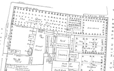
- This suggests that the well was in a more rural area at the time which fits with it being associated with the orchard area of the old Priory. A possible location is shown below based on John Rocque's 1747 map, where a circular structure is shown (highlighted in blue). However Chassereau's plan of Shoreditch in 1745 shows the well more to the west approximately in the position of the well shown in the conjectural plan below. If Rocque is right then the location of the well would be just to the west of the railway arches of Bateman's Row (see picture below).
|
|
| Detail from John Rocque's 1747 map showing the probable position of holy well marked in blue and a picture of the present location. |
|
| A conjectural plan of the Priory of St John the Baptist taken from Besant's survey of London published in 1906 shows two positions for the well. The first in the Great Court and the second in the Convent orchard. |
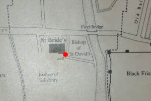
- St Bride’s Well, Fleet Street, EC4 (TQ 3151 8110)
- This well was located close to the south-east corner of the present church. St Bride’s is one of the oldest of the London churches and probably built upon an ancient shrine dedicated to the Celtic goddess Bridget. The well has disappeared under a modern house/office extension but evidence suggests that it was still providing water in the 19th Century. A beautiful specimen of one of London’s Plane trees lies close to the spot of the well, which we might suppose connects to its healing energies.
|
|
| One of London's Plane trees marking the spot of the well. |
Location of St Bride's well at the rear of the church. |
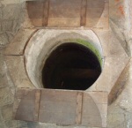
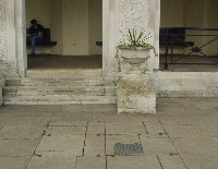
- Clerk’s Well, Farringdon Lane, EC4 (TQ3145 8212)
- Mentioned by Fitzstephen as early as 1174, the Clerk's Well was the scene of medieval miracle plays performed by the Parish Clerks of London, and gave its name to the district of Clerkenwell. Until the reformation, the well was located in the boundary wall of St Mary's Nunnery. After the dissolution of the nunnery and the destruction of its boundary wall, the well was located in the basement of a building in Ray Street (now Farringdon Lane). In 1800 a pump was placed at pavement level to facilitate public use but by the middle of the 19th century the well had been closed. The exact location of this important site was uncertain but was rediscovered in 1924, during building work in Farringdon Lane. After renovation in 1984, the Clerk's Well now has an accompanying exhibition outlining the history of the well and its environment.
|
|
| The present well, which can be visited by calling the Islington Local History Centre 020-7527-7988 |
Agas plan of Clerkenwell (1558) showing the church. The well can just be made out spouting from a fountain in the west wall into a trough. |
Other Wells
- St. Agnes Well- Kensington Gardens (TQ 2671 8068)
- I can find very little mention of this well, excepting the naming of St Agnes Villas on the other side of the Bayswater Road to be found on the 1830 Greenwood map of London. The well is situated close to the pump house facing the Italian Gardens and is marked by a small square metal cover.
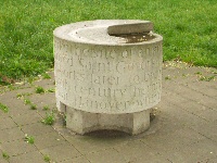
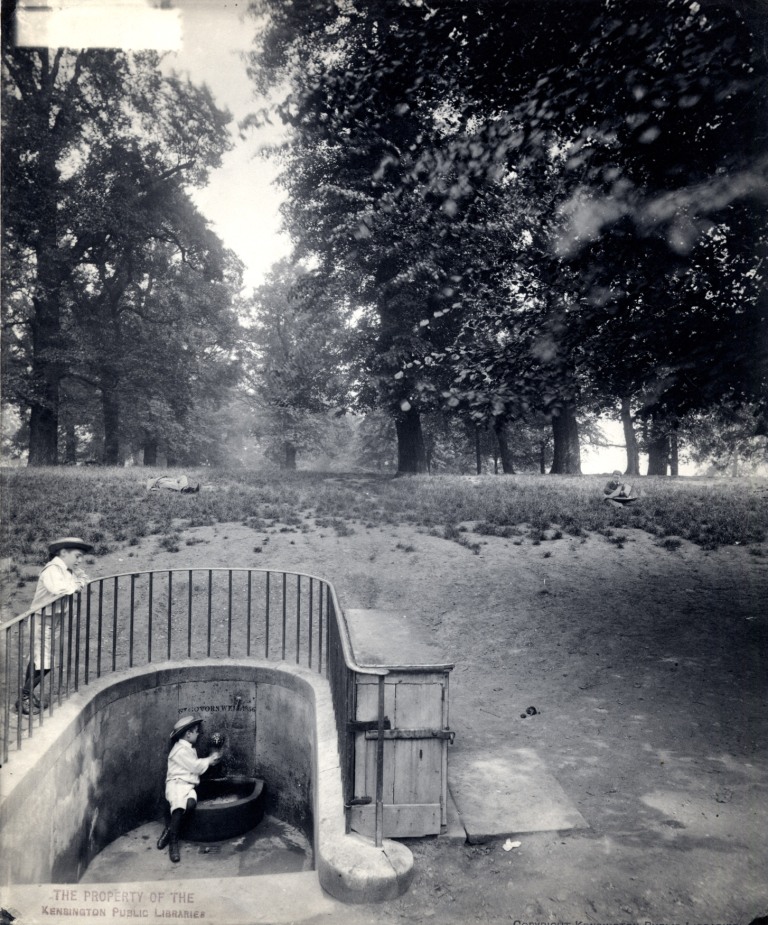
- St Govor's Well - Kensington Gardens (TQ 2611 7987)
- The inscription written around the well states: "This drinking fountain marks the site of an ancient spring, which in 1856 was named St Govor's Well by the First Commissioner of Works later to become Lord Llandover. Saint Govor, a sixth century hermit, was the patron saint of a church in Llandover which had eight wells in its churchyard." The well is mentioned in a story by J.M.Barrie the author of Peter Pan. A picture of the old well can be found in the Chelsea and Kensington archives. Please click here.
|
|
Site of St. Agnes Well - Kensington Gardens |
Site of St. Govor's Well - Kensington Gardens |
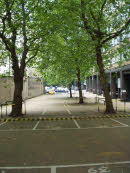
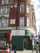
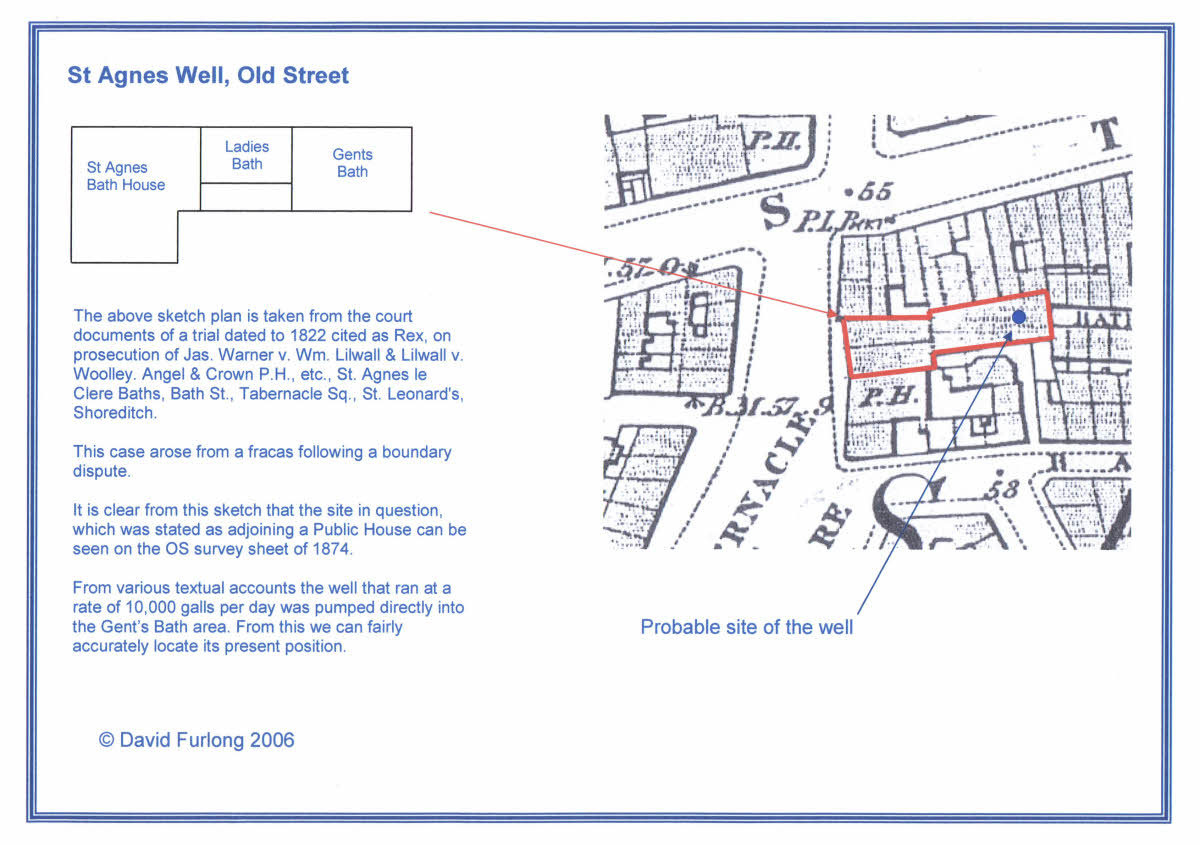
- St. Agnes Well - Old Street (TQ33074 82557)
- Of the well Stowe writes in 1603
- "Somewhat north from Holy-Well is one other well, curbed square with stone and is called Dame Annis the Clear
and not far from it, but somewhat west is also another clear water called Perilous Pond."
- By the time of Rocques Map in 1746 the name Dame Annis the Clear had changed to St Agnes Le Clare as evidenced by the name that later became associated with the Old Street roundabout. The indication from Stowe's description suggests that the well was located towards the eastern end of Old Street and the name St Agnes Le Clare (on Rocques Map) indicates the approximate position of the well, which almost certainly would now be found to the rear of the Foundry public house building in Old Street. This site is shortly to be developed and excavations will uncover the siting and positioning of the well, which reputed delivered some 10,000 galls of water a day.
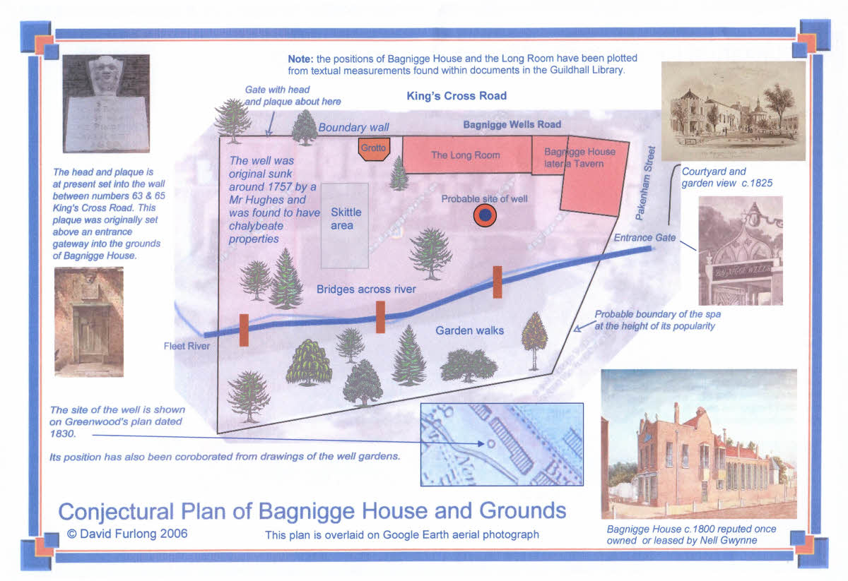
- Bagnigge Wells - King's Cross Road (TQ 3089 8259)
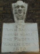
- There were two springs at Bagnigge wells, which became a very fashionable spa in the 18th century. The original site of the spa, Bagnigge House, was claimed to have been owned by Nell Gwynne the mistress of Charles II. In the rear garden ran the Fleet river, known as the river of "wells" because of the number of wells associated with it. Two wells were originally sunk around 1757 and had chalybeate properties. The wells became a very popular resort for taking "the waters" and for tea drinking, where the fashionable of London were wont to gather. Tea drinking eventually fell out of fashion and the spa fell into decline the site being sold off in the mid 19th century. A plaque of a man's head in the wall between 63 and 65 King's Cross Road now marks the position of the garden entrance to the spa, which originally extended to the junction of Pakenham Street.
|
Conjectural picture of Bagnigge Wells c.1790. Click image to enlarge |
-
- Black Mary Well - Farringdon Road (TQ 3101 8254)
- There are different suggestions for the origin of this strange name. Perhaps the most plausible is that the well was once owned by the Benedictine nuns of St Mary's, Clerkenwell. They were called black nuns because of the colour of their habit and thus the well could have belonged to 'Black Mary's'. The well is close to but quite separate from the Bagnigge wells. Its position now lies on a small piece of garden in front of some Council flats at the junction of Lloyd Bakery Street and Margery Street, although all trace has disappeared. The last reference to it in Cromwell's History of Clerkenwell stated:
- "Beneath the front garden of a house in Spring Place and extending under the froot pavement almost to the Pantheon Gate lies the capacious receptacle of a mineral spring, which in former times was in considerable repute, both as a chalybeate, and for its supposed efficacy in the cure of sore eyes. When Spring Place was erected (c. 1815) the builder ..converted the receptacle beneath into a cesspool for the drainage of his houses. "
- St Blaise's Well - Bromley (TQ 4080 6911)
- A chalybeate spring in the grounds of the Bishop of Rochester's Palace. This well still exists as a pump that feeds the adjoining lake.
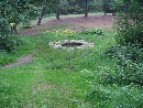
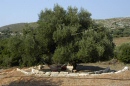
- Caesar's Well - Wimbledon (TQ 2236 7151)
- The well is part of an issuing spring that lies close to Caesar's camp on Wimbledon Common
- St Chad's Well - St Chad's Place (TQ 3050 8295)
- A once well known medicinal well that disappeared with the development of the Metropolitan railway line.
St Chad's Well is thought to be of very ancient origin, and was one of the most important of the many wells in London.
- Camberwell (TQ 3332 7609)
- This ancient well, which gave its name to this district of London, was re-discovered in 2009. (See references below).
- Kilburn Well - Kilburn High Street (TQ 2546 8368)
- Close to the site of the old Kilburn Priory. Now under the site of a health food shop.
A plaque in the wall of the shop honours the site of the well as does a more recent pavement plaque.
- Lady Well - Ladywell Road, Lewisham (TQ 3774 7486)
- The Lady Well was close to Ladywell Road, west of the river Ravensbourne.
It had probably been a holy well dedicated, like the nearby church, to St Mary the Virgin.
The first known record of it dates from 1592. It supplied water to the nearby dwellings until the building of a sewer in
Ladywell Road in 1855 caused it to run dry.
- Mus-Well - Muswell Road, NW10 (TQ 2887 9008)
- In Sunderland's book 'Old London, Spas, Baths and Wells' Mus-well is given holy well status claiming that it was named after 'Our Lady of Muswell' and there is a legend that a Scottish King had gained a cure when drinking the water. The well has long since disappeared but its original position would have been close to the junction of Muswell Road and Conniston Road. Another well close by was St. Dunstan's Well (TQ 2943 9058), which was well known in the fifteenth century but had almost disappeared by the 1800's. This would have been in the present Alexander Park Road not far from the junction with Talbot Road.
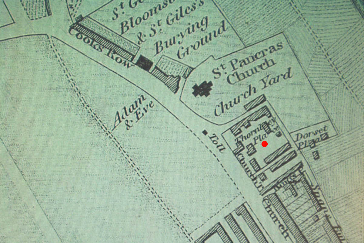
- St Pancras Well - St Pancras (TQ 2991 8345)
- The exact site of this well has been hard to determine, excepting that it lay to the south and reasonably close to the old St Pancras church. It resided in the garden of the house probably immediately to the south of the churchyard known as Thornley Place (see map). It was described for its healing properties 'in the greatest perfection and highly recommended by the most eminent physicians in the Kingdom'. It now, almost certainly, lies under the new railway development of St. Pancras station.
|
The probable site of the St. Pancras well, Now located under railway track. Click image to enlarge. |
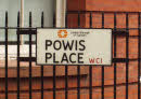
- Powis Well - Guildford Street (TQ 3034 8210)
- Shown on Rocques 1747 map. It lies at the rear of the Great Ormond Street Children's Hospital. A nearby street is named after the well.
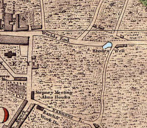
- Rhode's Well - Rhodeswell Road (TQ 3651 8163)
- Shown on Rocques Map and Fairburn's map 1801 but positions' vary. Probably accurately shown on Harwood's map, which is now close to Rhodeswell Road.
|
Rhode's well shown on Harwood's map dated 1800 |
- Shepherd's Well - Fitzjohn's Avenue, Hampstead (TQ 2662 8524)
- Shown on George Cruchley's 1835 map. Shepherd's well, also known as The Conduit,
provided a source of good quality soft drinking water for the residents of Hampstead.
The walk to the nearest road meant that well carriers sold water by the pail or two pails because
of the yoke needed for carrying the water. The spring never froze and only vary rarely ran dry. A plaque on the corner of Fitzjohn's Avenue and Lyndhurst Road marks the position of the well or close to it as its exact position is in the middle of the Road.
- Tottenham Wells
- A number of wells are recorded in a Tottenham including St. Loy's well (TQ. 3369 9004) [sometimes called St. Eloy's well], which would have been close to the corner of St Loys Road with Morefield Road and Bishop's well (TQ 3294 9128), the latter of which was claimed to have remarkable curative properties (Foord, 1910).
- Other Wells
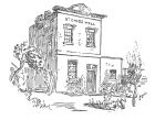
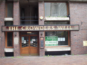
- A number of other wells are mentioned in John Stow’s (1525 – 1603) London survey, including, Skinner's well, Fagg's well, Loder's well and Radwell. I have been unable to locate the exact position of any of these wells. Another well Crowder's well, was located near the Barbican and is remembered in the name of a public house there.
|
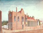
A photo of the Crowder's Well pub in the Barbican |
- Principle References:
- Sunderland S. - Old London' s Spas, Baths and Wells, (Bale and Danielsson) 1915
- Foord A. - Springs, Streams and Spas of London, (Fisher Unwin) 1910
- Stowe J. - London Survey 1598
- Strye J. - London survey update 1720
For information on the London's "leys" see:
London's Leys
For information on Camberwell see:
http://www.johnchaple.co.uk/camberswell.html
Other complementary information:
Devas
Water The Essence of Life - Channelling

|
For further information please write to:
David Furlong Myrtles, Como Road, Malvern Worcs WR14 2TH
Tel: +44 (0)1684-569105 or Mobile: + 44 (0)777-978-9047
Email:
David Furlong
|

David has been working as a healer, therapist and researcher for more than 40 years. He is the author of six books including The Healer Within and Working With Earth Energies
To contact David click here

The definitive book on Working
With Earth Energies.
Click here for more
details.
- These wells can be viewed on Google Earth.
Click here for more information on the Google Earth programme.
Click here to be emailed Google Earth file of the wells.
Holy Well Research Those interested in research of 'Holy Wells' or a discussion group of their origins please click here for the link to National Wells Index (NWI) forum.
Photos and plans:
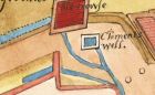
St Clements Well on a 1647 plan.
Painting of Bagnigge House c. 1757
The Bagnigge Wells Spa on 1830 map
The Bagnigge Wells sign at present set on building between 63 and 65 Kings Cross Road.
St Chad's Well from a London article dated to 1896
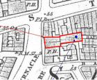
OS sheet 1874 shown the position of St. Agnes Well, Old Street. Click image for a detailed plan.
| |

.jpg)

